

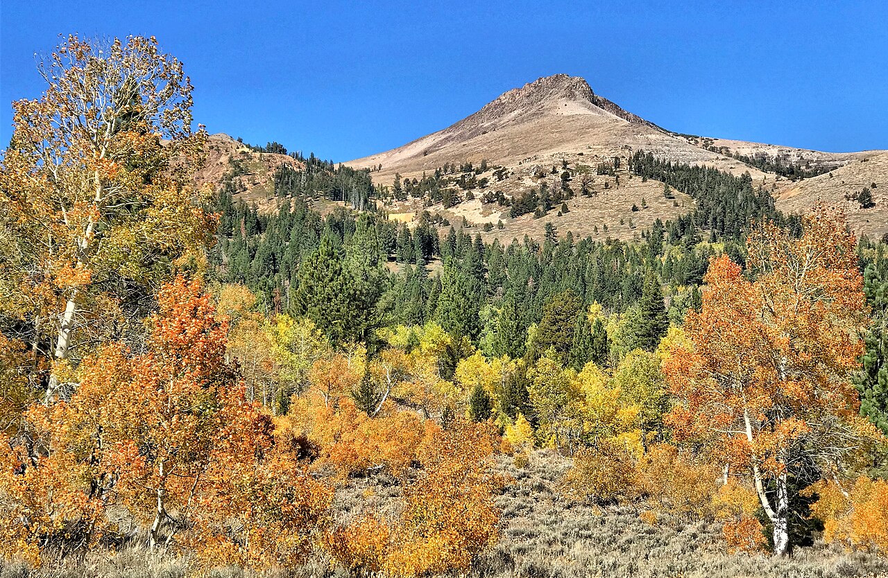
Lake Tahoe Fall Colors 2026: Best Spots, Peak Timing and Scenic Drives
Updated October 8, 2026.
For Lake Tahoe fall colors, start with Hope Valley for an aspen-lined drive, Taylor Creek for a short accessible walk, or Spooner Lake for a two-mile lake loop. Late September through October is a useful planning window, but individual groves change at different times. Choose a location first, then check recent local observations and conditions before traveling.
This is a planning guide, not a live foliage report. We have not verified that any location is at peak color today. The viewing windows below are seasonal guidance, not a forecast or a guarantee for 2026.
Eight Lake Tahoe Fall-Color Spots Compared
The choices below are editorial planning recommendations. Short walks, long scenic drives and mountain trails are different outings; choose the one that matches your group.
Swipe or scroll the table to compare all columns.
| Location | Choose it for | Walking and access | What to check |
|---|---|---|---|
| 1. Hope Valley | Aspen groves and a scenic drive | Highways 89 and 88; established parking and short walks | Road conditions, legal parking and private-property boundaries |
| 2. Taylor Creek and Rainbow Trail | A short, accessible family outing | About a half-mile paved interpretive trail and boardwalk | Seasonal facilities; bring drinking water |
| 3. Lam Watah and Rabe Meadow | A meadow walk close to Stateline | Choose a short out-and-back rather than committing to the full route | Trailhead access and current trail conditions |
| 4. Spooner Lake | A lake loop through aspen and forest scenery | About two miles around the lake, according to Nevada State Parks | Vehicle entry fee, park alerts and available daylight |
| 5. Fallen Leaf Lake | A smaller lake setting near South Shore | Narrow approach road and designated public access | Seasonal access and legal public parking |
| 6. Highway 89 toward Emerald Bay | Lake views with pockets of fall color | Designated overlooks and established stops | Highway restrictions and limited parking |
| 7. Tahoe City and the Truckee River outlet | A flexible town and waterfront walk | Choose your own distance near food and services | Local parking rules and suitable outdoor conditions |
| 8. West Shore and Sugar Pine Point | Forest contrast, shoreline scenery and historic grounds | Established public park paths and shoreline areas | Park fees, building hours and seasonal access |
When Do Lake Tahoe Fall Colors Peak?
There is no single peak date for the Tahoe region. Elevation, weather and the particular grove matter more than a calendar weekend. The North Tahoe tourism guide describes a broad viewing season from mid-September into late October, sometimes later. Visit Lake Tahoe recommends early to mid-October specifically for foliage around Rainbow Trail.
- September: Look for early changes, especially in higher or colder areas, rather than expecting every grove to be golden.
- Early to mid-October: A useful starting window for a foliage-focused trip, particularly a Taylor Creek outing. Verify current observations before choosing a date.
- Later October: Some protected groves and lower town areas may retain color, while exposed locations may already have lost their leaves.
Sources: North Tahoe fall-foliage guidance and Visit Lake Tahoe’s Rainbow Trail guide. These sources describe typical seasons, not the current color at every stop.
Before committing to a long drive, check the date and location of any foliage photo or report. An old photo, a road camera pointed at pavement, or a forecast for South Lake Tahoe cannot establish that a particular grove is at peak. Compare the broader trip tradeoffs in our September guide and October guide.
1. Hope Valley: An Aspen-Focused Scenic Drive
Hope Valley is our first choice for visitors who want a drive centered on aspen scenery rather than a lakefront walk. It lies south of the Tahoe Basin, so treat it as a separate outing instead of adding it to an already full lake-loop day.
From South Lake Tahoe: Follow US 50 toward Meyers, take Highway 89 south over Luther Pass, and continue to the Highway 88 junction in Hope Valley. Take the Highway 89 turn before climbing US 50 to Echo Summit. Check current restrictions on all three highways and choose established stops rather than stopping in a travel lane.
Visit Lake Tahoe describes this approach through Highway 89 and Luther Pass in its official fall travel guide. A map pin identifies the area; it does not grant permission to park or enter private land.
- Use established parking areas and legal turnouts. Do not park on dry vegetation or block gates.
- Respect ranch access, fences, private property and signed closures.
- Choose one or two short walks rather than stopping at every grove.
- Allow room to shorten the outing if weather or road conditions change.
Open the Hope Valley area map.
2. Taylor Creek and Rainbow Trail: A Short Family Walk
Rainbow Trail is an approximately half-mile interpretive route through forest and wetland habitat. Its paved path and boardwalk make it a useful starting point for families and visitors seeking an accessible outing rather than a mountain climb. Visit Lake Tahoe identifies early to mid-October as a good typical foliage window.
For the walking route, seasonal facilities and salmon-viewing timing, use our Taylor Creek and Rainbow Trail guide to plan this stop.
October 8 access check: the Taylor Creek operator lists visitor-center hours of 9 a.m. to 4 p.m., Thursday through Sunday, with the season ending Sunday, October 25, 2026. Buildings and trail access are separate checks. Bring your own water.
Read the Forest Service’s Taylor Creek access and facilities information. A proposed fee is not the same as an adopted charge; our 2026 recreation-fee proposal explainer covers that separate issue.
Do not promise salmon sightings on a fixed date. The Forest Service notes that spawning depends on environmental cues, including water temperature and flow, and can occur later than a typical early-October trip. Treat wildlife as a possible bonus rather than a guaranteed part of the itinerary.
Pair the walk with nearby Tallac Historic Site grounds when accessible. Check building and tour hours separately: an October foliage visit does not guarantee an indoor historic-house tour.
Open the Taylor Creek Visitor Center map | Compare easy family walks.
3. Lam Watah Trail and Rabe Meadow
Lam Watah is a practical choice near Stateline when you prefer a meadow and creekside walk to a longer mountain drive. The route passes through Rabe Meadow toward Nevada Beach. Fall interest comes from a mix of meadow vegetation, creekside plants and forest contrast, not a promise of continuous golden aspen.
Choose an out-and-back distance that fits the group. Check current trailhead access before depending on a particular parking lot, and turn around early when needed.
4. Spooner Lake: A Two-Mile Lake Loop
Nevada State Parks describes the trail around Spooner Lake as a flat two-mile loop. This is different from the longer backcountry route toward Marlette Lake. Choose the lake loop for a shorter nature outing and do not accidentally turn a family walk into a backcountry hike.
Vehicle entry fees checked September 7, 2026: $10 for Nevada vehicles or $15 for non-Nevada vehicles. The park lists day-use hours as sunrise to sunset. Consult the official Spooner Lake page for current fees, trail notices and water-quality alerts before visiting.
Golden foliage and water reflections can make this a worthwhile photography stop when conditions cooperate. Calm water, peak color and unrestricted access are not guaranteed.
Open the Spooner Lake State Park map.
5. Fallen Leaf Lake
Fallen Leaf Lake offers a smaller lake setting close to South Shore and can fit a Taylor Creek day when road access and parking allow. The attraction is the combination of water, mountains and scattered deciduous color rather than an uninterrupted wall of autumn leaves.
The narrow access road serves homes and recreation areas. Use designated public access, do not block traffic or driveways, and skip the extra drive when suitable parking is unavailable.
Open the Fallen Leaf Lake area map.
6. Highway 89 Toward Emerald Bay
This route combines lake and mountain scenery with pockets of fall color. It is a scenic-drive choice, not a guarantee of the concentrated aspen display visitors seek in Hope Valley.
For the complete lake loop or a shorter outing from your base, see our Lake Tahoe scenic-drive route and stop guide. Keep Hope Valley and other side trips separate when estimating your driving time.
Use designated overlooks and legal parking. Do not stand in the road for a photograph or treat a narrow shoulder as a parking space. Read the location limits of any Highway 89 closure before planning a West Shore loop.
Open the Emerald Bay State Park map | Check Caltrans Highway Conditions.
7. Tahoe City and the Truckee River Outlet
Choose Tahoe City for a flexible outing combining waterfront walking, the Truckee River outlet, Commons Beach and a nearby meal. This is a practical alternative to a long scenic drive when your group wants a shorter day.
Look for scattered color among town and creekside vegetation rather than expecting a large aspen grove. Check that outdoor conditions are suitable even when staying close to town.
Open the Commons Beach and Tahoe City map.
8. West Shore and Sugar Pine Point
West Shore combines forest contrast, shoreline scenery and historic grounds. Sugar Pine Point can anchor a slower park outing, with pockets of deciduous color rather than whole hillsides of changing leaves.
Use established public paths and check seasonal building hours, entrance fees and current park conditions. A grounds visit and a scheduled historic-house tour are separate plans.
Open the Sugar Pine Point State Park map.
Three Manageable One-Day Fall-Color Plans
South Shore family day
Begin with Rainbow Trail during suitable conditions, add a short Tallac grounds visit when accessible, then eat nearby. Make Fallen Leaf Lake optional rather than compulsory. Finish near your lodging instead of starting a full-lake loop late in the day.
Hope Valley scenic-drive day
Check US 50, Highway 89 and Highway 88 before leaving. Make Hope Valley the main outing, use legal parking for one or two stops, and leave enough time to return in daylight. Do not combine it with distant North Shore attractions just to fill the itinerary.
North or East Shore day
Choose Spooner Lake as the main walk, or stay with Tahoe City’s waterfront and nearby services for a lower-commitment day. A stop on a second shore is optional and should depend on traffic, weather and the group’s energy.
For a longer stay, use our one-, three-, five- and seven-day Lake Tahoe itineraries. Choose a base in the where to stay guide before planning multiple cross-basin drives.
Fall-Color Photography and Packing
Try morning or late-afternoon light, include water or evergreen forest for contrast, and leave room for wind to change the scene. Use only established public access. A photograph is not worth trampling a meadow, entering private land or obstructing traffic.
Pack warm layers, drinking water, snacks, sun protection, walking shoes and offline directions. Keep a charger and basic travel supplies in the car. Before a remote drive, check fuel and the conditions on the return route as well as the outbound route.
Road, Smoke, Weather and Recreation Access
Check these sources near departure. A foliage guide cannot confirm that a road, visitor center or trail is open on your travel date.
- Caltrans QuickMap and Highway Conditions for California route restrictions.
- Nevada 511 for the Nevada portion of your drive.
- National Weather Service Reno for forecasts and alerts.
- AirNow Fire and Smoke Map for air-quality information. A clear-looking webcam is not an air-quality reading.
- Lake Tahoe Basin Forest Service alerts and the managing park’s notices for recreation access.
Our Tahoe camera directory adds visual context, but cameras do not replace official restrictions or prove that leaves are at peak. Follow local emergency, closure and public-health instructions.
Fall Events and Nearby Meals
Pair an outing with an event on the same shore rather than planning around a long evening drive. Consult the October events guide or the October planning guide, then confirm event details with its organizer.
For a meal, compare the Lake Tahoe pizza guide or restaurants organized by shore. These links lead to the current guides rather than the old pizza ballot.
Frequently Asked Questions
What is the best month for Lake Tahoe fall colors?
October is a useful starting point, with possible viewing from September into later October depending on the grove. For Rainbow Trail, Visit Lake Tahoe recommends early to mid-October. Check recent local observations rather than treating that window as a guaranteed peak.
Where should I look near South Lake Tahoe?
Consider Hope Valley for a dedicated drive, Taylor Creek and Rainbow Trail for a short walk, or Lam Watah for an outing near Stateline. Fallen Leaf Lake can be an optional stop when public access and parking allow.
Can I see fall colors without a strenuous hike?
Yes. Rainbow Trail is approximately half a mile, and Tahoe City allows a flexible town walk. Spooner Lake’s approximately two-mile loop is longer but described as flat by Nevada State Parks. Match distance and conditions to the group.
Is Hope Valley inside the Tahoe Basin?
No. It is south of the basin, reached from South Lake Tahoe through Highway 89 over Luther Pass to Highway 88. Plan it as a separate outing rather than a quick stop on the lakeshore.
Are these places free?
Not all of them. The Forest Service currently lists Taylor Creek as having no entry fee, while Spooner Lake lists a $10 Nevada-vehicle or $15 non-Nevada-vehicle day-use fee. Check each destination’s current rules; a free view does not guarantee free parking.
Can I bring a dog?
Rules vary by site and trail. At Taylor Creek, leashed pets are allowed on the trails but not in or near Taylor Creek Marsh or inside the Stream Profile Chamber. At Spooner Lake, Nevada State Parks requires pets to be leashed. Read the linked managing-agency rules before choosing a route.
More Lake Tahoe Fall Planning
Best time to visit | Family activities and indoor backups | Free and lower-cost outings | Quieter public places | All Tahoe guides.
Featured photo credit: “Fall colors in Hope Valley, California” by Jonathan Cook-Fisher, used under CC BY 2.0 through Wikimedia Commons.