

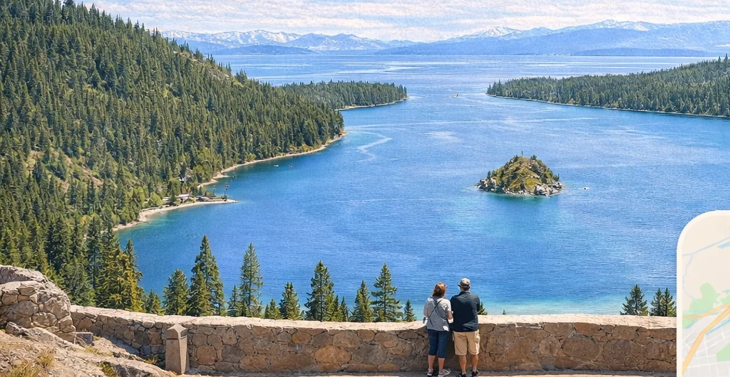
Lake Tahoe Scenic Drive
The drive around Lake Tahoe is about 72 miles, excluding side trips. Allow roughly three hours for driving alone, then add time for traffic, parking, meals and walks. For a relaxed day, our suggestion is to choose two or three stops from the route below.
Route and access sources checked September 8, 2026.
How long does it take to drive around Lake Tahoe?
Visit Lake Tahoe lists a 72-mile loop, not including side trips. Visit Reno Tahoe estimates about three hours without stops. Treat that as a planning estimate, not a promised arrival time.
Our recommendation: reserve most of a day if the drive itself is your main outing. Combine an Emerald Bay overlook, a food break in Tahoe City and one beach or lakeside walk. A long hike, boat tour or full beach afternoon belongs on a separate day.
Only have a few hours? Pick a shorter drive near your base. For a first visit centered on activities, use our one-, three-, five- and seven-day itineraries instead of trying to visit every shore in one day.
The clockwise loop from South Lake Tahoe
This example starts in Stateline and visits Emerald Bay first. Follow current road signs and navigation for each leg, with these towns and highways as your route checkpoints.
- Stateline to the South Lake Tahoe “Y”: US 50 west. Travel through South Lake Tahoe to the junction with CA 89.
- South Lake Tahoe to Tahoe City: CA 89 north. Follow signs toward Emerald Bay, then continue along the West Shore through the lakeside communities to Tahoe City.
- Tahoe City to Crystal Bay: CA 28 east. Take the lake route toward Kings Beach. CA 28 becomes NV 28 when you cross into Nevada.
- Crystal Bay to the US 50 junction: NV 28. Continue through Incline Village and along the East Shore past Sand Harbor toward the Spooner junction.
- Return to Stateline: US 50 toward Zephyr Cove and South Lake Tahoe. Follow the lake side of the junction, rather than heading toward Carson City.
Open the official loop map and route brochure (PDF)
Starting on the North Shore? Join the loop where you are staying and rotate the sequence. You do not need to drive to Stateline first. Truckee, Donner Lake and Mount Rose are separate side trips that add distance.
Clockwise or counterclockwise?
Choose the direction that puts your most important stop first. From the South Shore, clockwise reaches Emerald Bay before the North and East Shores. If you have a morning Sand Harbor reservation, reverse the sequence to reach the East Shore first. Neither direction guarantees parking or avoids traffic.
Six stop options, in clockwise order
Choose two or three. Open a stop for its parking or access notes before adding it to your day.
Three shorter alternatives
From South Lake Tahoe: Emerald Bay and back
Take CA 89 toward Emerald Bay, choose one legal overlook stop and return the same way. Check that the road is open first. Add the Vikingsholm hike only if that is your main outing. This keeps the day focused on the southwest corner of the lake.
For a day built around a shoreline hike, compare the Rubicon Trail starting points and parking. Choose your walking route and return plan first, then keep the drive to a few nearby stops.
From Tahoe City or Kings Beach: the North Shore
Follow CA 28 between Tahoe City and Kings Beach. Choose one town for food and one shoreline walk, then return toward your base. You can enjoy a lakeside outing without extending the trip through Emerald Bay and South Lake Tahoe.
From Incline Village: the East Shore
Use NV 28 toward Sand Harbor, with a confirmed parking or entry plan for your destination. If you prefer to leave the car in a designated lot and walk, read our Tahoe East Shore Trail guide first. Walking the trail takes its own time and does not turn roadside parking into an option.
Road conditions and parking checks
- Check both states before leaving. Use Caltrans QuickMap for CA 89, CA 28 and US 50 in California, and Nevada 511 for NV 28 and US 50 in Nevada. Our conditions page brings the official tools together.
- Do not assume the whole loop is open in winter. Caltrans has documented storm closures around Emerald Bay. Check current restrictions and chain controls; shorten or postpone the outing if conditions require it.
- Check your vehicle against each stop’s limits. A route suitable for a passenger car can still have parking lots that exclude RVs or trailers. Read the park’s current rules before driving to that entrance.
- Keep a backup stop. A full lot is a reason to continue to another permitted destination, not to park on the highway shoulder. Budget for parking at more than one site.
Lake Tahoe scenic drive questions
Can you drive around Lake Tahoe in one day?
Yes, when the full route is open and conditions allow. Make the drive the day’s main activity and select a few stops. Trying to combine the loop with major hikes, a cruise and several beach visits is a much more demanding plan.
Is the full drive always next to the water?
No. The route passes through towns, forested stretches and roads above the shoreline. The official brochure helps you choose designated stops for lake views. Keep your attention on the road and pull into a permitted space before taking photos.
Is the entire loop the Lake Tahoe National Scenic Byway?
No. The designated byway described by Visit Lake Tahoe follows the Nevada side on US 50 and SR 28 between Stateline and Crystal Bay. This guide covers the larger loop through both states.
Can I add Truckee or Donner Lake?
Yes, but those are side trips outside the core 72-mile loop. Count the extra driving and time at the destination separately. With limited time, choose either the full lake loop or a focused North Tahoe and Truckee outing.