

6 Easy Lake Tahoe Hiking Trails for Families and Young Kids
Updated October 25, 2026.
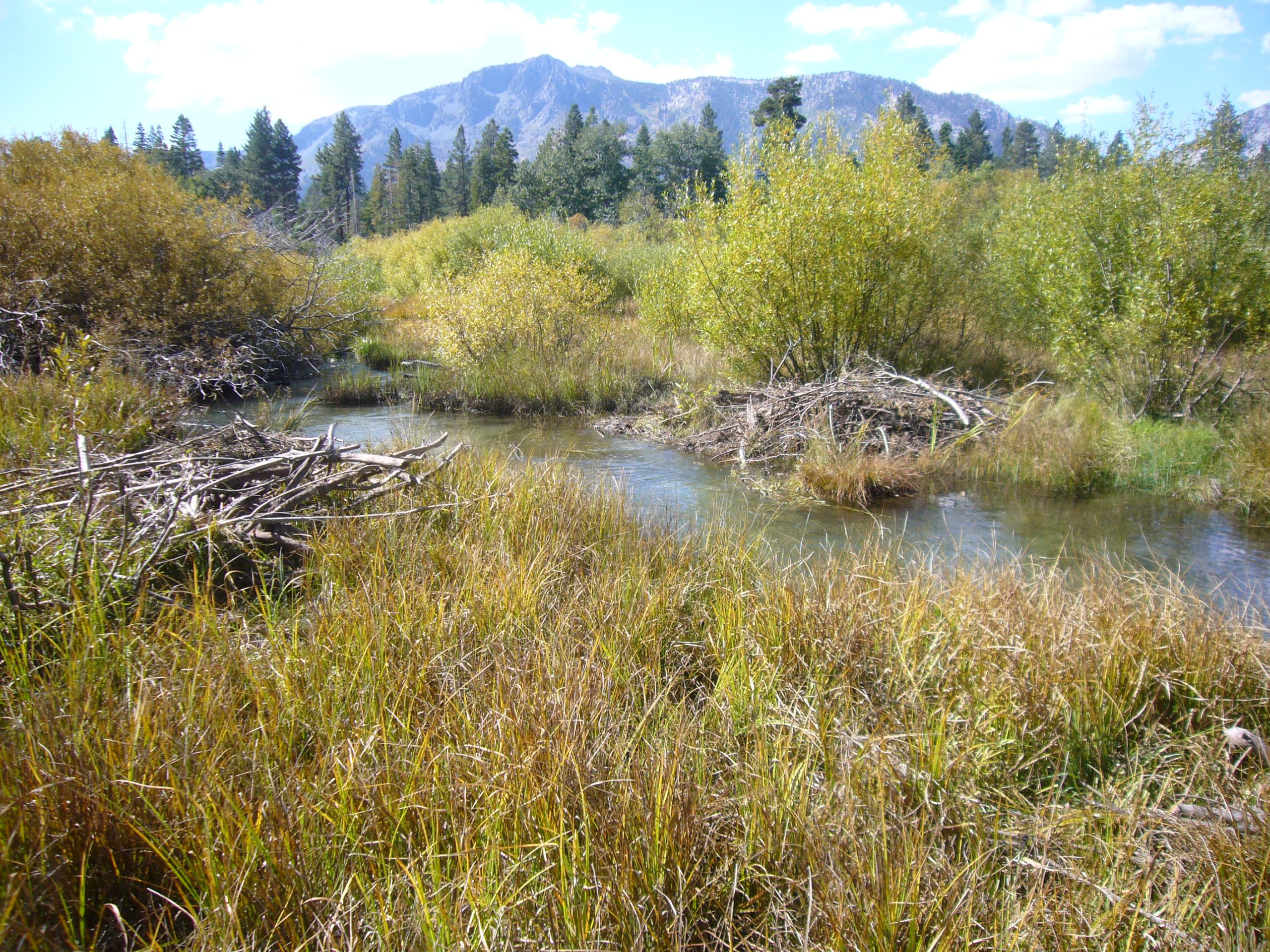
Cover: Taylor Creek wetland, September 2012, by Schmiebel / Wikimedia Commons, CC BY-SA 3.0. Resized/cropped display copies retain that license. Archival landscape photograph, not today’s trail or water conditions.

For an easy Lake Tahoe family walk, start with Rainbow Trail for a short nature loop, the Pope-Baldwin Bike Path for a flexible paved outing, or a short section of the Tahoe East Shore Trail for lake views. Choose the route by the youngest walker’s ability, the surface and the return distance, not simply whether a trail is described as easy.
This guide covers six walks rather than six mountain climbs. Stroller and accessibility suggestions assume suitable conditions; snow, ice, maintenance and individual mobility needs can change whether a route works for your group.
Short nature loop: Rainbow Trail at Taylor Creek.
Flexible paved outing: Pope-Baldwin Bike Path.
Lake views on pavement: Tahoe East Shore Trail, with some climbing.
Near Stateline: Lam Watah Trail through Rabe Meadow.
Compare Six Easy Lake Tahoe Walks
Distances below include the stated return. Time allowances are our planning estimates for relaxed family walking with breaks, not measured walking times or accessibility certifications.
| Walk | Distance and suggested time | Surface, effort and best fit |
|---|---|---|
| Rainbow Trail | About 0.5-mile loop; allow 45–75 minutes. | Pavement and boardwalk; shortest nature loop here. Accessible in the Forest Service description, subject to conditions. |
| Lake of the Sky / Tallac | About 1 mile out and back to the shore; 60–90 minutes. Tallac adds distance. | Mixed paths and beach edge; do not assume a continuously paved circuit. |
| Pope-Baldwin | Choose 20 minutes outward, then return; allow 50–60 minutes with stops. | Paved shared-use path; cyclists and access-road crossings matter. |
| East Shore Trail | 3 miles one way / about 6 out and back. Use a shorter timed walk for children. | 10-foot-wide pavement; hillside section reaches up to 8% grade in Tahoe Fund’s description. Not level. |
| Lam Watah / Rabe Meadow | About 2–3 miles for beach options; allow 1.5–2.5 hours or turn earlier. | Paved bike path and separate dirt/sand trail; choose the intended branch. |
| Stateline Lookout | Tourism brochure: 1.7 miles round trip; allow 1.5–2 hours. | Uphill approach and viewpoint paths. Better for children who can manage the climb than for a level stroller outing. |
1. Rainbow Trail at Taylor Creek
Choose this for a compact nature loop when paths and seasonal access suit your group. Start at Taylor Creek Visitor Center on Visitor Center Road off SR 89, just beyond the Tallac/Fallen Leaf Lake Road area when approaching from South Lake Tahoe. Follow the signed Rainbow Trail loop back to the center rather than adding a beach spur by accident.
The Forest Service short-hike guide gives the loop as half a mile. It passes forest, meadow and creek habitat on pavement and boardwalk. Our 45–75-minute allowance includes looking at interpretive stops; no salmon sighting is promised.
Forest Service visitor information lists no site fee, accessible facilities and Rainbow Trail, seasonal parking and flush toilets, and no potable water. Carry water. After closure, use the dated portable-toilet/parking notice above rather than expecting the indoor facilities. Pack out waste.
Rainbow Trail: stroller, dog and seasonal checks
Use the site’s accessibility description as a starting point, then check whether snow, ice, debris or maintenance affects the path on your date. The Forest Service allows leashed dogs on the trails but excludes them from the marsh and Stream Profile Chamber; stay on the signed route and follow any local restriction. A closed indoor viewing chamber does not by itself close the outdoor loop.
For a trip centered on fall wildlife, read our Taylor Creek guide and fall-color planning notes. Do not approach bears or leave the trail to get closer to fish.
See the Taylor Creek arrival map below.
2. Lake of the Sky Trail and Tallac Historic Site Grounds
Choose this when your group wants a shoreline destination and can retrace the route. The Forest Service lists Lake of the Sky Trail as half a mile from Taylor Creek to Lake Tahoe. Budget about one mile out and back, before shoreline wandering or any Tallac extension.
Make the shore the turnaround for a first visit. If the surface becomes too loose for the stroller or mobility device, turn before reaching sand. The lake is a stopping point, not an instruction to continue through every adjacent recreation area. Allow 60–90 minutes with pauses; the actual starting point and route add or subtract walking.
Tallac is an optional second outing: its vehicle entrance is on Heritage Way opposite Fallen Leaf Lake Road, with parking at the west end. The Forest Service lists free grounds access, many accessible paths and buildings, seasonal flush toilets and seasonal water. Buildings generally operate Memorial Day weekend through September; grounds foot access and seasonal parking are separate. Do not rely on toilets or water after closure.
Pope House has a limited-access ramp arranged in advance through 530-541-5227 in summer. That building provision does not certify the whole shore-to-Tallac route for a particular device. For a short visit, choose one starting point and return to it.
Open the Tallac Historic Site arrival map.
3. Pope-Baldwin Bike Path
Choose this for a paved out-and-back whose length you control. Visit Lake Tahoe describes more than three miles of path paralleling SR 89, with access to Camp Richardson, Tallac and nearby beaches. You do not need to finish the entire path to have a worthwhile walk.
Our short-walk plan: use Taylor Creek’s legal seasonal parking, find the signed connection to the paved path, and choose one direction. Start a 20-minute outward timer; turn sooner for tired children, congestion or unsuitable conditions. Allow about 50–60 minutes total with breaks, including the connection. This is a time limit, not a measured half-mile segment or a promise to reach a named beach.
The tourism source lists Taylor Creek as a parking option, with paid alternatives at Pope and Baldwin beaches. The free Taylor Creek site still has seasonal gates and services. A beach parking fee, rented bicycle and meal are separate costs. Do not improvise highway-shoulder parking if the lot is shut or full.
Pope-Baldwin: keep a flexible walk from becoming a longer circuit
Stay on the paved shared-use path, keep children to one side and stop clear of bicycle traffic. Access roads need a separate crossing check. Beach roads and the Tallac spur add distance; skip them if the group has reached its turnaround time. Carry water and use a restroom before setting off rather than depending on a seasonal concession.
If Taylor Creek access is unavailable, choose another verified starting facility or a town outing. This guide does not recommend walking in from an unverified roadside space.
Use the Taylor Creek map and the closure note to plan this starting option.
4. Tahoe East Shore Trail
Choose this for lake views when your group can manage a paved hill and the return climb. The original Incline Village–Sand Harbor segment is three miles each way. A full out-and-back is about six miles plus lot access. That is a substantial family walk, despite the smooth surface.
Tahoe Fund’s trail description gives a 10-foot width and a maximum grade of 8%, with the first mile on the mountain side before the underpass and remaining lakeside section. That grade describes slope, not total elevation gain. Beach access spurs may be steeper or unpaved; the paved main trail does not make every cove accessible.
Young-child version: walk south from the signed paved trail entrance for up to 20–30 minutes, then retrace the route. This may turn around before the lakeside section. Do not promise Hidden Beach or Sand Harbor on a timed short outing. Bring water and sun protection; exposed sections and bridges have little shade.
Arrival: TTD’s Ponderosa lot is at 1102 Tahoe Boulevard, with 90 listed spaces and paid hourly parking. It is separate from Tunnel Creek Café’s parking. Pay on arrival using the posted kiosk/phone instructions and your plate number; carry a credit card. Designated accessible spaces still require payment for ordinary disability placards. Winter snow can restrict lot access.
East Shore parking: a worked autumn cost example
TTD’s published Ponderosa rate chart, checked October 25, lists fall Friday–Sunday rates of $4/hour at 9–11 a.m. and $5/hour at 11 a.m.–3 p.m. Two hours entirely within those blocks would be $8 or $10 per vehicle, before any checkout fees. A stay crossing a price boundary needs its actual time-based quote.

The chart has seasonal and holiday columns; use the kiosk’s current rate for your arrival. Free evening parking does not extend the trail’s daylight hours. If parking fills, use a verified operating transit service or change the outing; SR 28 roadside parking is prohibited. Do not copy the older Tahoe Fund article’s 2019 shuttle fare or payment code.
Travel Nevada lists sunrise-to-sunset trail hours, benches and restrooms. Locate an operating toilet before beginning rather than assuming every facility is available. Sand Harbor is a separate admission decision; check our Sand Harbor guide before adding beach entry.
See the Ponderosa arrival map and keep the return route in your plan.
5. Lam Watah Trail Through Rabe Meadow
Choose this for a meadow outing near South Shore lodging, with an optional beach turnaround. Douglas County distinguishes the paved bike path from the Lam Watah dirt trail; both lead toward Nevada Beach. Start at Kahle Drive off US 50. The county lists a parking lot, signs, restrooms and a picnic table, but does not establish year-round restroom hours.
Travel Nevada gives 193 Kahle Drive, free entry and fewer than 20 free parking spaces. It describes flat packed-sand and paved surfaces with 2–3-mile outing options. The Forest Service’s shorter description gives one mile to the shore; different branches, loops and beach wandering explain why you should not treat every mapped option as the same distance.
For the full beach option, plan roughly 2–3 miles out and back and 1.5–2.5 hours including stops. For a toddler or uncertain mobility fit, use a 20-minute outward limit and return the same way. Avoid adding the longer route to Round Hill Pines. Sand at the beach is a separate surface challenge, and the packed-sand trail is not a guarantee for a small-wheel stroller.
The site is day use and dog-friendly on permitted routes. Keep dogs leashed, remove waste and check the beach’s separate restrictions. Lam Watah has Washoe cultural significance; stay on the trail and leave cultural features untouched. Forest Service route reference.
Open the Kahle Drive starting-point map.
6. Stateline Lookout
Choose this for a North Shore viewpoint when everyone can manage an uphill walk. This is above Crystal Bay, not the South Shore town of Stateline. The regional trail brochure (PDF) lists a 1.7-mile round trip. Allow 1.5–2 hours with viewpoint stops rather than treating a half-mile approach description as the whole outing.
The brochure directs visitors up Reservoir Road, then right onto Lakeview Avenue to the gate, with very limited residential parking. The Forest Service identifies the start as the iron gate at Road 1601; its street wording differs from the brochure. Use the trailhead map and posted signs, not a summit pin as a driving destination. Do not block a gate, driveway or private access between the gates.
The Forest Service lists no fee, day use only, seasonal parking, vault toilets and no potable water. Toilets and trash service are unavailable in winter. Bring water and use an earlier toilet stop if facilities are not confirmed. Tahoe Fund documents benches and interpretive panels along the lookout outing.
Choose Rainbow Trail or a suitable short paved path if the group needs a more predictable low-effort outing. This guide does not establish a measured maximum slope or certify the lookout route for a stroller or wheelchair. Snow and ice make the uphill/downhill return a different trip.
Open the Crystal Bay trailhead map.
Popular Tahoe Trails That Are Not Equivalent to an Easy Paved Walk
Eagle Falls and Eagle Lake, Eagle Rock, Monkey Rock and Cascade Falls require a different assessment from the paths above. Short distances can still involve climbing, rocky footing, steps or exposed edges. Do not substitute a famous viewpoint trail for a stroller route without checking its terrain.
Compare more demanding outings separately in our Lake Tahoe hiking guide.
Arrival maps for the two paved-trail starting areas
These are arrival maps, not measured trail tracks or confirmation of today’s parking availability. Save the official Tahoe Trail map (PDF) for orientation; its 2019 service details need current checks.
How to Choose a Route With a Stroller or Toddler
Start with the surface and the return distance. Rainbow Trail offers a short loop; Pope-Baldwin allows a flexible paved out-and-back; East Shore offers pavement but has grades and a much longer full-route return.
For a toddler walking independently, use an early turnaround and leave room for breaks. For a stroller, check current surfaces, slope, width and access to your starting point. A general accessibility description does not establish that every stroller or mobility device will be suitable in every condition.
Choose before parking: a stroller or mobility-device decision
If a short loop with an official accessibility description is the priority: start by checking Rainbow Trail. Call Taylor Creek at 530-543-2674 and ask about the connection from the available parking, current boardwalk surface, and which toilet is operating. Ask whether that toilet meets your access needs; the seasonal notice’s mention of portable toilets does not establish their accessibility.
If a known gentle maximum slope is essential: this guide does not establish a suitable route for your particular limit. East Shore’s published 8% maximum means eight feet of vertical change per 100 feet horizontally at that grade; it is not the climb over the whole route. A 20-minute turnaround does not remove the initial hill. Stateline Lookout is an uphill option with no verified maximum grade here. Do not use either as a level-path substitute.
If the issue is wheel traction or crossings: Lake of the Sky’s shoreline sand, the dirt Lam Watah branch and construction detour need a different assessment from pavement. Pope-Baldwin offers a paved option, but its parking connection, access-road crossings and bicycle traffic still matter. Choose the shortest confirmed connection, turn before an unsuitable surface, and keep an indoor or lodging-based backup if current access cannot be established.
These are route-selection decisions from the cited information, not a device-specific approval or a new field survey. A destination’s general accessibility label does not answer every part of the journey from parking to the trail and toilet.
Family Hiking Safety and Weather Backups
Check closures, smoke, thunderstorms, snow and road conditions before leaving. Carry water, snacks, sun protection and a warm layer, let the slowest person set the pace, and turn around before anyone becomes exhausted. Keep children away from exposed edges and fast water, and do not approach wildlife.
Use the Forest Service alerts and the managing park’s notices for access. A summer walking recommendation is not a winter route recommendation.
When outdoor conditions are unsuitable, consider the indoor family options after confirming their hours. During smoke, follow local health guidance; an indoor attraction is not automatically a clean-air shelter.
Build a Family Day Without Too Much Driving
One easy South Shore morning
When Taylor Creek’s lot is accessible, locate the day’s toilet option and fill water before arrival. Choose the Rainbow loop, allow 45–75 minutes, then eat a packed snack at a permitted picnic spot. Make Lake of the Sky optional only if everyone is comfortable with another roughly mile out and back. Do not make both trails mandatory.
One short East Shore outing
Pay for enough parking to unload, walk and return. Use a 20–30-minute outward limit on the paved trail, take breaks off the travel lane, then retrace to Ponderosa. A two-hour parking window leaves flexibility, but check your actual return time. Save a full Sand Harbor visit for a separate plan if the group cannot complete the return.
Calculate the full walk before choosing it
At an illustrative 1.5 mph moving pace, a 0.5-mile loop takes 20 minutes of walking, a 1-mile out-and-back takes 40 minutes, and the 6-mile East Shore return takes 4 hours before any breaks. At 1 mph, that full return becomes 6 hours. Neither calculation predicts a child’s pace, and climbs, stops and parking access add time.
For an out-and-back, reaching the destination uses only half the distance budget. If a child tires 20 minutes out, the return still remains. Choose the shorter loop or turn earlier rather than relying on an unverified shuttle.
Backup near your base: Explore Tahoe at 4114 Lake Tahoe Boulevard lists daily 10 a.m.–5 p.m. hours for a short South Shore indoor stop. On the North Shore/Truckee side, use our family indoor guide to check museum hours and admission before driving. In poor road conditions, choose a lodging-based break instead of crossing the basin for a backup.
Preview Taylor Creek’s nature and learning experience
What does Reddit have to say?
In the historical “Tahoe with a stroller” discussion, u/gwmccull highlighted the hill at the start of the East Shore path. The original poster, u/itsakellygirl, later reported enjoying the paved Incline route by bicycle with a child trailer. The thread was displayed as six years old when reviewed October 25, 2026.
Those accounts describe different ways of using the route; neither proves that a toddler can walk the full return. We use them as a reminder to match the route to the actual mode and effort. The thread’s suggested roadside drop-off and old access assumptions are not recommendations in this guide.
Editorial method: route and facility descriptions were checked against the linked land-manager, transportation and tourism sources on October 25, 2026. Time budgets and combinations are our planning calculations. We have not conducted a new field accessibility survey or measured every route’s elevation gain.
Easy Lake Tahoe Family Hiking FAQs
Which walk should we try first with young children?
Rainbow Trail is a useful first choice for a short nature loop in suitable conditions. Check seasonal parking and facilities before leaving, and bring drinking water.
Is the Tahoe East Shore Trail three miles round trip?
No. The trail between Incline Village and Sand Harbor is three miles one way. Retracing the full route makes an approximately six-mile walk. Choose a shorter segment for a lower-effort outing.
Which options work for a stroller?
Consider Rainbow Trail, Pope-Baldwin Bike Path or a short East Shore Trail segment. Surface condition, slope and the particular stroller matter, so check the route rather than relying on the word paved alone.
Can we combine an easy walk with fall colors?
Yes, with seasonal expectations rather than guaranteed foliage. Start with the fall-color locations, maps and typical timing, then choose a walk suited to the group.
Do these routes stay easy in winter?
Not necessarily. Snow, ice and closed seasonal facilities can change the outing completely. Use current access notices and choose a separately planned winter activity rather than treating this guide as a snow-route assessment.
Related Lake Tahoe Family Guides
Things to do with kids | Family beaches | Free and lower-cost activities | Trip itineraries | Camera and road-information directory.