

Lake Tahoe Waterfalls: Hiking Trails, Maps & Parking
Find a short waterfall stop or plan a longer mountain hike.
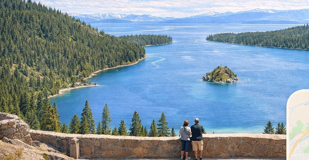
By the I Love Lake Tahoe editorial team · Checked October 25, 2026. This is a researched comparison, not a personal trail report. The featured Emerald Bay image is an illustration; the dated Glen Alpine photographs below show actual scenery.
For a short Lake Tahoe waterfall hike, start with Upper Eagle Falls near Emerald Bay. Choose Cascade Falls for a rocky walk overlooking Cascade Lake, or Lower Glen Alpine Falls for a short approach near Fallen Leaf Lake. Farther north, Shirley Canyon has a waterfall-lined trail, while Galena Falls is a longer outing from Mount Rose Summit.
The right choice depends on where you are staying, how far you want to walk and the season. These are different kinds of outings: a short distance can still involve stairs, exposed rocks or a difficult parking situation. Use the comparison below before picking a trailhead.
Compare five Lake Tahoe waterfall outings
| Waterfall / start | Return distance and effort | Dry-trail time allowance |
|---|---|---|
| Upper Eagle Falls Eagle Falls trailhead |
About 0.5 mile; stone steps and uneven rock. Continuing to Eagle Lake makes the total about 2 miles return. | 30–60 minutes for the upper falls; allow 1.5–2.5 hours for the lake outing. |
| Cascade Falls Bayview trailhead |
About 1.5–2 miles; roughly 200 feet of climb in the tourism authority’s trip account. Rocky, exposed sections. | 1–2 hours. |
| Lower Glen Alpine Fallen Leaf Road area |
Short roadside approach; no fixed distance because legal stopping space varies. Uneven, unfenced viewpoint. | 20–40 minutes at the falls, after finding legal parking. |
| Shirley Canyon waterfalls Olympic Valley |
For a short visit, turn back at the first seasonal cascade reached on the established trail. The lake extension is about 4 miles return in the operator’s July 2026 guide; steep and rocky. | Allow 45–90 minutes from the trailhead for a short cascade visit, including stops; add the parking approach. A lake hike takes several hours. |
| Galena Falls Mount Rose Summit |
About 5 miles return; The Outbound lists 794 feet of cumulative gain. Start around 8,900 feet. | 3–4 hours; add time for altitude, rests and your group’s pace. |
Times are our planning allowances for suitable dry-trail conditions, including short stops—not measured completion times. They exclude driving and parking searches. Climb estimates are attributed below; the short roadside stop and variable Shirley turnaround do not have a single comparable elevation gain.
Find the right side of the lake
Distances describe the routes below, not every trail with the same waterfall name. Check trailhead signs and current access before walking.
1. Upper Eagle Falls: a short hike near Emerald Bay
Choose it for: a short waterfall outing while visiting the Emerald Bay area. Start at Eagle Falls Picnic Area and Trailhead on Highway 89. The approximately half-mile return walk to the upper falls includes stone steps and uneven rock. Use the established trail and viewing area, keeping clear of the water’s edge.
Upper Eagle Falls and Lower Eagle Falls have different approaches. The lower falls can be reached from the Vikingsholm area below the highway; that trip includes a climb back out of Emerald Bay. The visitor authority’s waterfall guide explains the two routes.
Want a longer hike? The Forest Service distance table gives Eagle Lake as one mile each way. That outing enters Desolation Wilderness: Recreation.gov requires a free day-use permit year-round, obtained from a Forest Service office or trailhead supplies in summer. Do not count on a stocked self-issue box off-season. A parking payment and a wilderness permit are different things.
Parking and facilities, checked October 25: the Forest Service’s individual Eagle Falls page currently lists $5 per vehicle, seasonal restrooms, picnic tables and leashed pets. Its general seasonal description says mid-May to mid-October, while the 2026 facility schedule lists November 15. Follow current signs and conditions; winter has no restroom or trash service. The state-park lot across the highway has separate rules and charges.
Open Eagle Falls trailhead map
2. Cascade Falls: a rocky trail above Cascade Lake
Climb context: Visit Lake Tahoe’s trip account estimates 200 feet of gain on a two-mile return. Its author describes the path narrowing and becoming rocky while carrying an infant. That is an attributed experience, not proof the route suits every child or stroller.
Choose it for: a shorter hike with lake views as well as waterfall scenery. Begin at Bayview Day Use Area and Trailhead off Highway 89, across from Inspiration Point. Allow for roughly 1.5 to 2 miles round trip: the visitor authority lists 1.5 miles on its trail page and 2 miles in its Emerald Bay overview.
The rocky footing matters more than that small mileage difference. Wear shoes with traction and keep children close around exposed areas. Stay back from the lip of the waterfall; this is not a place to scramble toward the drop for a photograph.
Parking and permits: the Bayview/Inspiration Point pass page requires a use fee and says to arrive before buying the first-come pass using posted QR instructions. Download and sign into the Recreation.gov app ahead of the trip. It does not promise a reserved parking space. The direct Cascade route is outside Desolation Wilderness, so it does not require that wilderness permit. Granite Lake and longer wilderness routes from Bayview do. Cascade Lake is private; remain on the public trail.
Seasonal arrival, checked October 25, 2026: Visit Lake Tahoe’s closure schedule lists Bayview Day Use Area and Trailhead for October 12; the September 30, 2026 announcement confirms the year. This is a scheduled closure of parking and facilities, not a blanket closure of national forest land to walk-in visitors. Do not plan on an open parking area or available restrooms. Check current conditions before leaving; possible walk-in access does not establish a safe winter route or a legal roadside parking place. Dates can change with weather and conditions.
Fee and access confirmation: neither the pass page nor the Forest Service’s Bayview page displays a current dollar amount. Do not substitute Eagle Falls’ $5 fee. For a firm budget or off-season visit, ask the Lake Tahoe Basin office at 530-543-2600 (weekdays 8 a.m.–4:30 p.m., excluding federal holidays) about the fee and gate access. The individual page still shows an open badge despite the dated October 12 closure schedule; that badge alone is not confirmation that the lot is open. Bayview has no potable water, and winter restroom/trash service is unavailable.
3. Lower Glen Alpine Falls: a short approach near Fallen Leaf Lake
Choose it for: waterfall scenery with little trail walking, provided you can park legally. Lower Glen Alpine Falls is near the southern end of Fallen Leaf Lake. This is the lower roadside waterfall, separate from the upper falls and longer hikes beginning at Glen Alpine Trailhead.
Access is the main challenge. Fallen Leaf Road becomes narrow, with passing pullouts. Beyond the store and fire station, parking near the falls is extremely limited. Keep passing places, driveways and emergency access clear. If there is no legal place to stop, move on rather than blocking the road.
Do not assume that a short approach means an accessible viewpoint. Ground near the falls is uneven and the edge is not fenced. The visitor authority’s Lower Glen Alpine Falls guide describes the access constraints.
Open Lower Glen Alpine Falls map
If step-free access is essential: do not rely on Lower Glen Alpine as the day’s destination. The tourism account explicitly describes no designated parking spaces; this review establishes neither a legal accessible stall nor a continuous firm, step-free approach. Choose a verified option in our accessible Tahoe beaches guide instead, and check its current access before traveling. At Glen Alpine, no legal stopping space means skipping the stop.
4. Shirley Canyon: waterfalls in Olympic Valley
Choose it for: a mountain outing from Olympic Valley with several waterfalls along the way.
Start and turnaround: park in the main resort lot and walk to the signed trailhead at the end of Shirley Canyon Road. Palisades asks hikers not to park in the trailhead neighborhood. North Tahoe’s tourism listing places the trailhead about a quarter-mile from the Tram Building and the first seasonal waterfalls about 10–15 minutes along the trail, with rocks and some climbing. These are orientation estimates, not a measured accessible route or a promise of flowing water.
A short Shirley waterfall visit, without committing to the lake
Follow the signed creekside trail to the first cascade you can view from stable ground without leaving the route. Make that your turnaround and retrace your steps. Our 45–90-minute trailhead-to-trailhead allowance includes viewing stops and a slower rocky descent; add the walk from your parking space. This is an editorial time budget, not a fixed mileage or elevation-gain claim. Turn sooner if markings become unclear or the footing is unsuitable; do not keep climbing merely to reach a waterfall on a map.
For a brief visit, the large exposed granite slab is a stop point, not an obstacle you need to climb. Do not confuse a short cascade outing with the longer Shirley Lake or High Camp hike. Download the resort trail map before setting out.
The lake and High Camp are longer objectives: the operator’s July 2026 guide lists two miles one way to Shirley Lake and 3.5 miles to High Camp, with 1,920 feet of gain for the High Camp route. The current trail directory also lists the 3.5-mile route with 1,920 feet uphill. Based on the July guide, the lake outing is roughly 4 miles returning the same way, before any additional parking approach. Do not assign the High Camp climb figure to a short waterfall visit. The older blog’s three-mile-to-lake/five-mile-to-High-Camp description differs; use the current map and your chosen start.
Tram check, October 25, 2026: the official operations page lists the Aerial Tram as closed and summer rides closed for the season. Plan to walk back down. A future ride down is an option only after confirming that day’s operation and last departure.
Open Shirley Canyon trailhead map · Check resort operations.
5. Galena Falls: a longer hike from Mount Rose Summit
Climb and parking: The Outbound’s 4.97-mile out-and-back listing gives 794 feet of cumulative elevation gain. Treat it as that publisher’s route estimate, not a surveyed measurement. The TRTA parking directory warns that the paved Mount Rose Summit lot commonly fills by mid-morning on summer weekends. Use the signed lot; keep the Relay Peak Road gate clear.
Choose it for: a mountain hike from the northeast side of Tahoe. Start at Mount Rose Summit Trailhead on Nevada State Route 431. Check the destination carefully: this is separate from the ski resort and Galena Creek Visitor Center.
The out-and-back to Galena Falls is about 5 miles, returning along the same trail. The trailhead sits around 8,900 feet, so give yourself time to adjust and take breaks. Bring water, food, sun protection and layers.
Keep the route clear: reaching the falls does not require climbing Mount Rose itself. Continuing to the summit is a separate, much more demanding trip. There is also a longer loop option, but its mileage should not be confused with the 5-mile return walk described here. Friends of Nevada Wilderness explains these route choices.
Open Mount Rose Summit trailhead map
When is the best time to see Lake Tahoe waterfalls?
Spring snowmelt and early summer generally offer stronger waterfall flow than late summer or fall. Timing changes with the snowpack, elevation and weather. The visitor authority’s seasonal waterfall overview is a useful starting point, but an old photograph does not establish today’s flow.
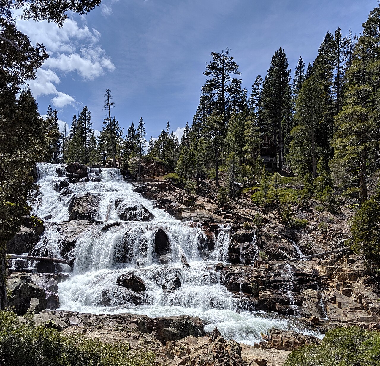

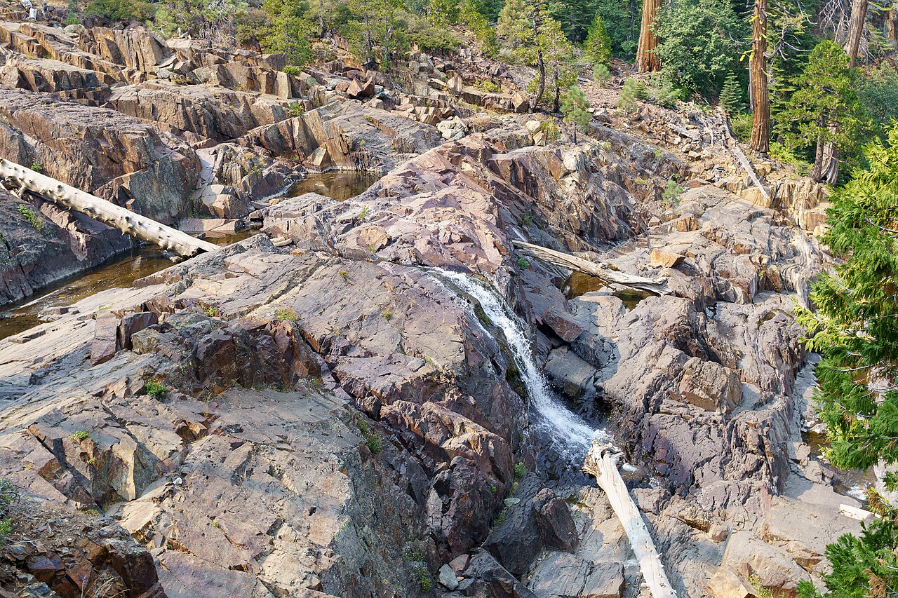

These are different years and camera positions at Glen Alpine Falls, not a controlled before-and-after comparison. They show why a spring photograph should not set expectations for every fall visit. Neither establishes today’s flow, water depth or a safe place to stand. Both resized images retain their CC BY-SA 4.0 licenses.
A September or October visit can still be a worthwhile hike, with more modest waterfall expectations. Check our Lake Tahoe weather guide before choosing a day. Snow-covered or icy access calls for a different plan from the dry-trail outings described here.
Plan one waterfall outing around your day
Start with your base, your walking limit and the return route. These three examples are editorial planning choices, not guided tours or field-tested schedules.
A short Emerald Bay stop: choose Upper Eagle first
Allow 30–60 minutes after parking for the upper-falls walk, then reassess your energy before adding anything. The published federal lot fee is $5 per vehicle; it does not establish admission or parking rights in the separate state-park lot. If the legal lot is full, move to another planned activity rather than improvising a highway shoulder stop.
The Eagle Lake extension changes the walk from about half a mile to two miles return and adds the wilderness-permit requirement. Lower Eagle Falls changes the route entirely: descend via the state-park trail and budget the climb back up.
One Emerald Bay hike: Cascade or Eagle Lake?
Choose Cascade for lake views and a shorter, rocky route when Bayview access is available. Choose Eagle Lake for the alpine-lake destination and a longer uphill walk with a free wilderness permit. Their similar mileage does not make the surfaces or logistics identical.
Doing both totals roughly 3.5–4 walking miles before any parking approach, plus a move between trailheads. That calculation is why we recommend picking one for a relaxed half-day, leaving the second optional.
A North Shore hiking day: Shirley or Galena?
From Olympic Valley, start with Shirley and set a turnaround before committing to the upper granite or High Camp. From the northeast shore or Reno approach, Galena offers a clearer five-mile return destination, but at high altitude. Neither becomes a short walk merely because the waterfall is the goal.
Start with the morning forecast and an offline map, choose your return deadline and keep the day on that side of the basin. A closed trail, icy surface or full legal lot is a reason to use a town-based alternative, not to force the itinerary.
Before leaving the trailhead
- Permits: Eagle Lake and other Desolation Wilderness extensions require a free day permit year-round; trailhead supplies are seasonal. Direct Cascade Falls does not enter that wilderness.
- Dogs: Eagle’s Forest Service trailhead allows leashed pets, while Lower Eagle’s state-park approach prohibits them. Palisades describes Shirley as dog-friendly, but steep granite can still be unsuitable for an individual dog. Follow posted rules on your exact route.
- Facilities: Eagle has seasonal toilets; Mount Rose’s trailhead has a restroom in the route source. Do not assume facilities remain operational in fall or winter. Bring water and pack out waste.
- Edges: view from established paths and stable ground well away from waterfall lips. A dry-looking rock is not an invitation to cross the channel. Do not use this hiking guide as swimming or winter-route advice.
Compare other Tahoe hikes or choose a town-based alternative.
Why these other waterfalls are separate choices
- Lower Eagle Falls: included as an alternative to the upper stop, not the same half-mile walk. The tourism guide describes about 2.1 miles return from the Vikingsholm lot. State Parks lists a substantial return climb on the Vikingsholm approach; dogs are not allowed. Read our Emerald Bay access guide before descending.
- Fontanillis Lake Falls: a longer Desolation Wilderness objective, not a casual add-on to Eagle or Cascade. The Forest Service lists Fontanillis Lake itself 4.9 miles one way from Eagle; that lake mileage is not an exact waterfall-track measurement. Plan the actual route, permit and return daylight separately.
- Horsetail Falls: west of the basin near Twin Bridges, with rough route-finding and slippery-rock concerns in the visitor authority’s guide. It is a separate mountain trip, not a replacement roadside stop when Emerald Bay is busy.
- Van Sickle’s seasonal waterfall: convenient to Stateline in suitable conditions, but current access needs a fresh check. Nevada State Parks’ October 23 notice schedules vehicle gates and facilities to close November 2, 2026. Much pedestrian access continues, with a Nevada construction closure; do not assume the whole waterfall approach is unaffected.
What do visitor accounts add?
In his August 15, 2018 Galena Falls account, guidebook author Tim Hauserman reported finding the summit lot full before 9 a.m. His alternative start added more than a mile each way. This is a historical personal report, not a prediction for your date, but it illustrates why changing parking can change the hike.
What does Reddit have to say?
In a May 18, 2025 Olympic Valley discussion, one commenter suggested Shirley Canyon while another described difficult route-finding and preferred stopping at Shirley Lake. Those are individual opinions, not a consensus or current trail report. The operator’s own warning about steep, non-beginner terrain is the stronger basis for choosing a turnaround. Check current tram arrangements rather than relying on old comments about free rides.
Lake Tahoe waterfall questions
Which waterfall needs the least hiking?
Lower Glen Alpine Falls has a short roadside approach, but parking and uneven ground can make it inconvenient. Upper Eagle Falls offers a short established trail with stairs. Neither should be assumed to be stroller or wheelchair accessible.
Which waterfall hike is best for young children?
Choose for your children’s stamina and ability to stay close on rocky terrain. A waterfall edge adds a supervision challenge even on a short outing. If you need a gentler walk or stroller option, start with our easy Lake Tahoe hikes for families.
Can you visit these waterfalls in winter?
Do not treat these descriptions as winter route instructions. Snow, ice, road restrictions and changing access can alter the outing. Check the land manager’s current information before considering a winter visit.